About Ospringe
Ospringe is a village and civil parish in the English county of Kent. It had a population of 715 in 2001. Located south of Faversham, Ospringe forms part of the Borough of Swale. It lies on the Roman road Watling Street (nowadays the A2 road), called Ospringe Street in the village.
Another section of the village lies on Water Lane leading southwards towards Painters Forstal. The remains of substantial Roman buildings have been found to its north west; the ruins of the abandoned Stone Chapel lie nearby.
From Wikipedia - click for full entryProfile Stats:
Members do not see ads
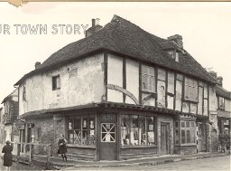
Maison Dieu, Ospringe, 1941
Added by @iamtimbo 10 years ago / Views: 862In Gallery: Maison Dieu, Ospringe, 1910s, 1941 and 2002
This building is the main surviving building of the medieval Maison Dieu, founded in 1230, which was similar to a small monastery. It acted as a...
View detail
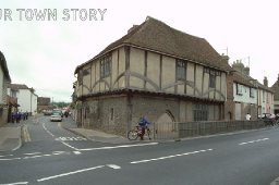
Maison Dieu, Ospringe, 2002
Added by @iamtimbo 10 years ago / Views: 625In Gallery: Maison Dieu, Ospringe, 1910s, 1941 and 2002
This building is the main surviving building of the medieval Maison Dieu, founded in 1230, which was similar to a small monastery. It acted as a...
View detail
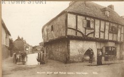
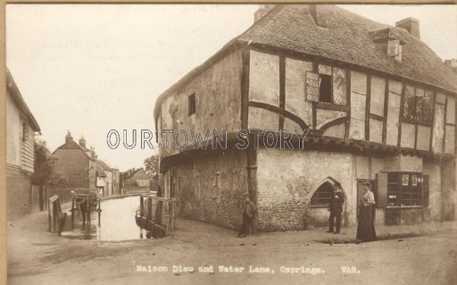
Maison Dieu, Ospringe, c. 1910
Added by @iamtimbo 10 years ago / Views: 872In Gallery: Maison Dieu, Ospringe, 1910s, 1941 and 2002
This building is the main surviving building of the medieval Maison Dieu, founded in 1230, which was similar to a small monastery. It acted as a...
View detail
Our Town Story Members do not see any ads